
Burlington, Ontario
Between the lake
and the escarpment.
A city at the head of Lake Ontario with the Niagara Escarpment behind it — and roughly half its land area kept as protected countryside.
Half city, half countryside,
and all of it on the lake.
Burlington sits at the head of Lake Ontario in Halton Region, between Hamilton and Oakville with the Niagara Escarpment rising behind it. It was a village in 1873, a town in 1915, and a city from 1974.
Burlington — 186 km² on the lake
0
Residents
(2021 Census)
0 km²
Land Area
0
Became a City
0.4
Median Age
The Waterfront
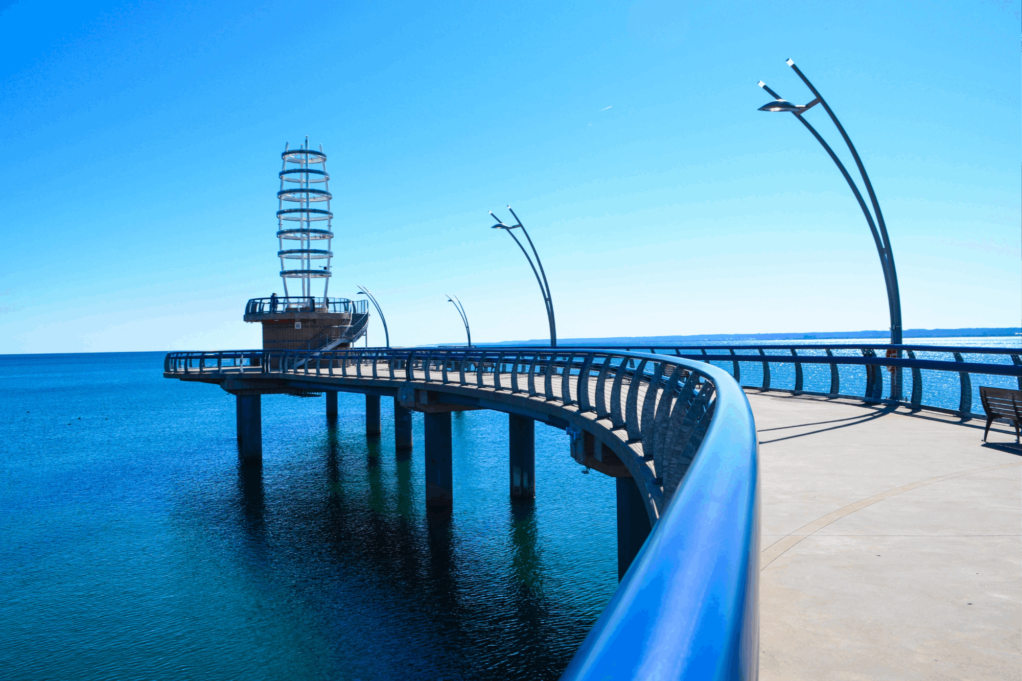
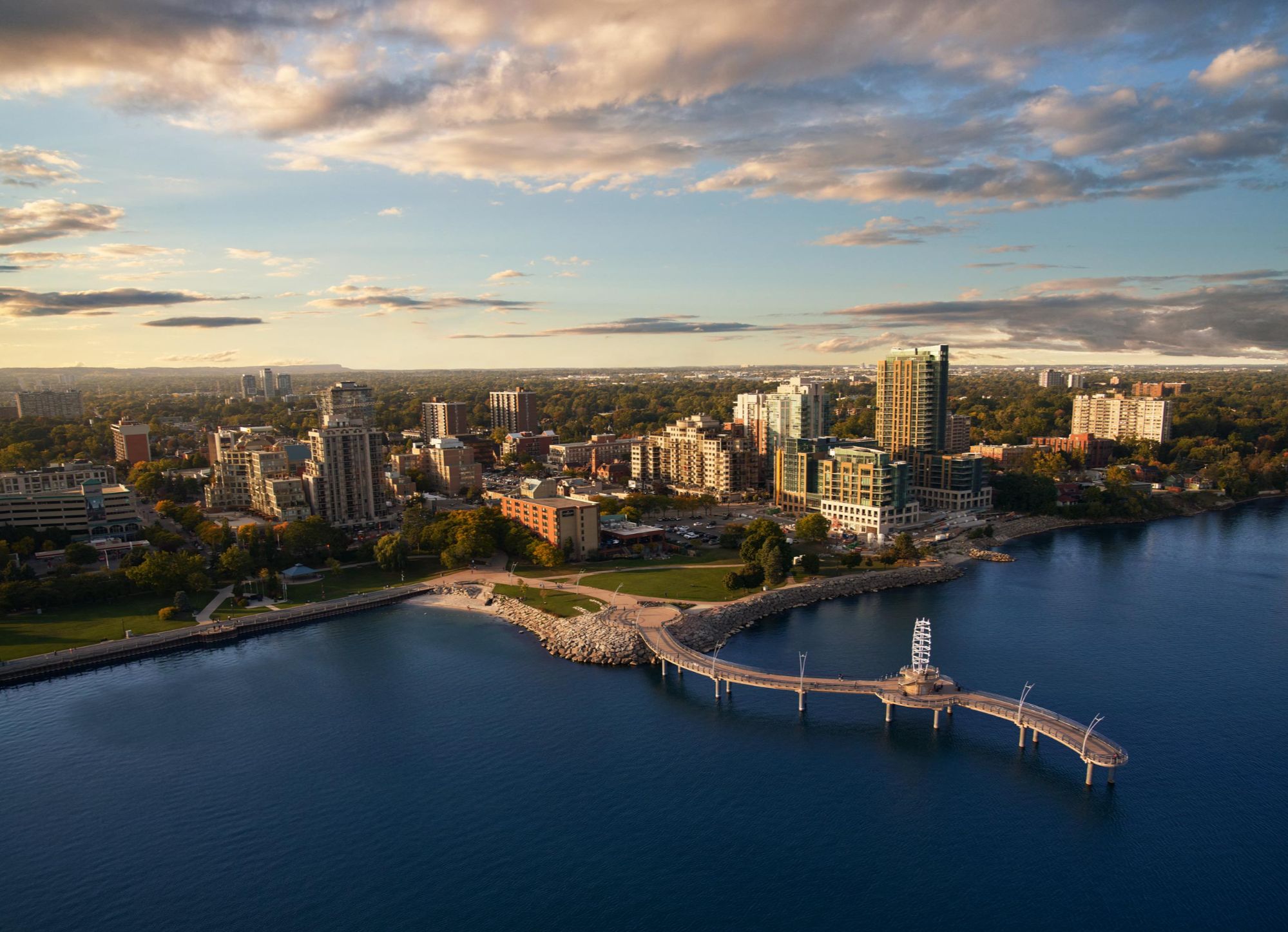
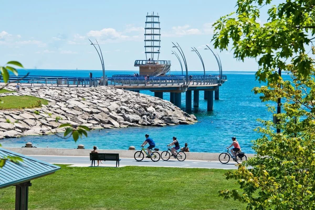
Spencer Smith Park, the Brant Street Pier, Beachway Park and a promenade that runs the length of downtown — the lake is the front yard here.
The Escarpment
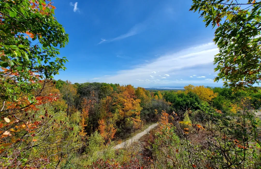
The Niagara Escarpment runs behind the city, with the Bruce Trail, Mount Nemo and Rattlesnake Point all inside or minutes from the boundary.
Half of It Is Countryside
Roughly half of Burlington's land area north of Dundas is protected Greenbelt and rural land — farms, hamlets and conservation areas rather than subdivisions.
A Walkable Downtown
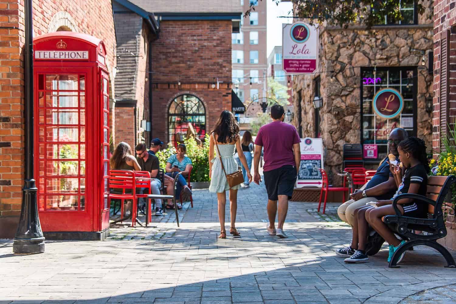
Brant Street runs from the pier up through restaurants, shops and the performing arts centre — a small core people actually walk.
Three GO Stations
Aldershot, Burlington and Appleby on the Lakeshore West line, plus the QEW, 403 and 407 — Toronto one way, Hamilton the other.
The Royal Botanical Gardens
Canada's largest botanical garden straddles the Burlington–Hamilton line, with nature sanctuaries and trails around Cootes Paradise.
Population, area and median age from the 2021 Census of Population (Statistics Canada).
What People Love
Why people move here
and then stay.
Ask ten Burlington residents why they chose it and you'll get roughly these six answers.

Fun Facts
Six things you probably
didn't know about Burlington.
Two centuries between a bay and an escarpment, and a few surprises along the way.
In 1784 Captain Joseph Brant — Thayendanegea — was granted roughly 3,400 acres at the head of the lake. The settlement that grew there was called Wellington Square.
Burlington incorporated as a village in 1873, became a town in 1915, and only became a city in 1974 — with its modern boundaries drawn in 1958.
The Royal Botanical Gardens spans the Burlington–Hamilton line, with cultivated gardens, nature sanctuaries and trails wrapped around Cootes Paradise.
North of Dundas, roughly half of Burlington's land area is protected Greenbelt — farms, hamlets like Lowville and Kilbride, and escarpment conservation land.
The Sound of Music Festival has run in Spencer Smith Park since the 1980s and is one of Canada's largest free music festivals.
Canada's oldest and longest marked footpath crosses Burlington along the escarpment, taking in Mount Nemo and Rattlesnake Point on the way.
Sources include the City of Burlington, Museums of Burlington, the Royal Botanical Gardens, the Canadian Encyclopedia and Statistics Canada.
Every corner of the city,
and what it's actually like.
Burlington isn't one market — it's twenty-one of them. Choose a neighbourhood to see the schools, parks, commute and housing mix that define it.
South · Lakefront
The core on the water
Brant Street runs from the pier up through restaurants, patios and the performing arts centre. Spencer Smith Park is the front yard, and the whole core is small enough to cross on foot.
Schools
Central PS, Burlington Central HS
Parks & Green Space
Spencer Smith Park, Brant Street Pier, Waterfront Trail
Getting Around
Burlington GO close; QEW at Brant
Walkability
Very walkable
Housing
Condos, century homes, semis
South · Central
A step back from downtown
Immediately east of the core, mixing older streets with apartment and townhouse pockets. Everything downtown is a walk or a short bus away.
Schools
Burlington Central HS, Maple Grove PS
Parks & Green Space
Central Park, Amherst Park, Lions Park
Getting Around
Burlington GO; QEW at Guelph Line
Walkability
Walkable
Housing
Post-war detached homes, townhomes, apartments
South · Central
Burlington's oldest address
A 1920s garden suburb south of New Street, with a mature canopy, deep lots and generational homes. Consistently the top of the city's market.
Schools
Tuck PS, Nelson HS, Pineland PS
Parks & Green Space
Roseland Park, Sioux Lookout Park, lakefront parks
Getting Around
Burlington GO; QEW at Guelph Line
Walkability
Somewhat walkable
Housing
Century homes, mid-century detached, custom rebuilds
South · Central
Central and attainable
North of New Street around Guelph Line, with a good share of the city's condo and townhouse supply and quick access to the GO and the QEW.
Schools
Robert Bateman HS, Clarksdale PS
Parks & Green Space
Sherwood Forest Park, Central Park nearby
Getting Around
Burlington GO minutes away; QEW at Guelph Line
Walkability
Somewhat walkable
Housing
Townhomes, condos, detached homes
South · East
Quiet family streets
Between Walkers and Appleby south of the QEW, built out in the 1960s and 70s. Established, well-treed, and close to the lake without paying lakefront prices.
Schools
Nelson HS, Pineland PS, Frontenac PS
Parks & Green Space
Nelson Park and Pool, Optimist Park
Getting Around
Appleby GO; QEW at Walkers Line
Walkability
Somewhat walkable
Housing
Side-splits, bungalows, detached homes
South · East · Lakefront
Lakeside, and priced like it
South of New Street to the water around Appleby Line. Large lots, mature trees and lakefront properties — one of the strongest markets in the city.
Schools
Nelson HS, John T. Tuck PS, Pineland PS
Parks & Green Space
Paletta Lakefront Park, Burloak Waterfront Park, Shoreacres Creek
Getting Around
Appleby GO; QEW at Appleby Line
Walkability
Car-dependent
Housing
Custom rebuilds, estate lots, mid-century homes
South · East
Steady, established, close in
North of Shoreacres around Appleby and New Street. A mix of detached homes, townhomes and condos, with the Appleby GO a short drive away.
Schools
Robert Bateman HS, Pineland PS
Parks & Green Space
Pinedale Park, Sheldon Creek trails
Getting Around
Appleby GO; QEW at Appleby Line
Walkability
Somewhat walkable
Housing
Detached homes, townhomes, condos
Southeast · Lakefront
The Oakville edge
Burlington's southeastern corner against Burloak Drive, with quiet streets running down to the lake and Burloak Waterfront Park at the bottom.
Schools
Robert Bateman HS, Florence Meares PS
Parks & Green Space
Burloak Waterfront Park, Elizabeth Gardens Park
Getting Around
Appleby GO; QEW at Burloak
Walkability
Car-dependent
Housing
Bungalows, custom rebuilds, newer infill
West
Its own place entirely
The city's western edge against Hamilton, with waterfront parks, a huge tree canopy, a GO station of its own and a steady wave of new development along Plains Road.
Schools
Aldershot HS, Tom Thomson PS
Parks & Green Space
LaSalle Park and Marina, Hidden Valley Park, RBG trails
Getting Around
Aldershot GO on the Lakeshore West line; 403 and QEW
Walkability
Somewhat walkable
Housing
Character homes, bungalows, new mid-rise condos
West
The corridor that's changing
Along Plains Road between Aldershot and downtown, where much of Burlington's new mid-rise is going up, backed by the Royal Botanical Gardens.
Schools
Aldershot HS, Mohawk Gardens PS
Parks & Green Space
Royal Botanical Gardens, Hidden Valley Park
Getting Around
Aldershot GO; 403 at Waterdown Road
Walkability
Walkable
Housing
Mid-rise condos, townhomes, older detached homes
Northwest
Hills, trees and a golf course
Built into the escarpment slope around the municipal golf course. Large lots, mature trees and privacy, with the 403 right at the bottom of the hill.
Schools
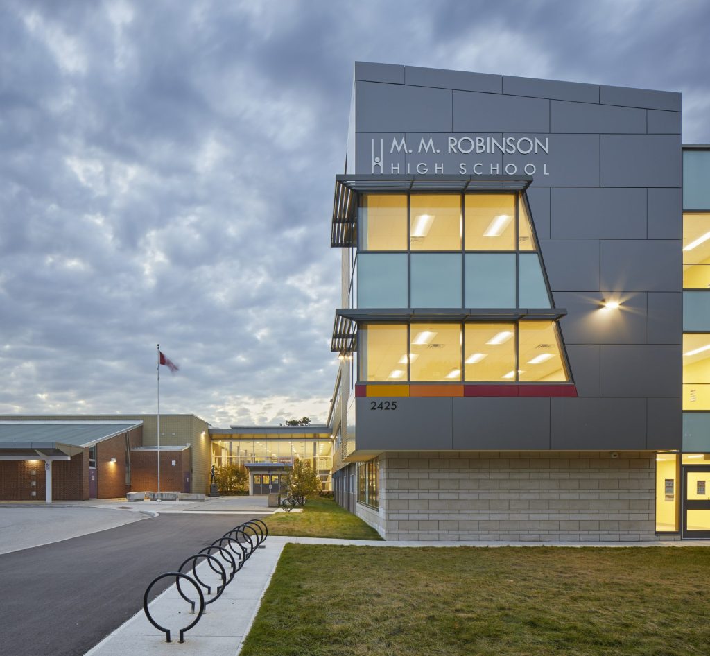
M.M. Robinson HS, Tecumseh PS
Parks & Green Space
Tyandaga Golf Course, Kerncliff Park, Bruce Trail
Getting Around
Burlington GO; 403 at Brant Street
Walkability
Car-dependent
Housing
Large detached homes, 1970s builds, some rebuilds
Northwest
Value at the escarpment
West of Brant Street below the escarpment, with a community pool and arena at its centre and some of the more affordable detached homes in the city.
Schools
M.M. Robinson HS, Mountainside PS
Parks & Green Space
Mountainside Park and Pool, Kerncliff Park
Getting Around
Burlington GO; 403 close
Walkability
Somewhat walkable
Housing
Post-war bungalows, semis, townhomes
North · Central
Established and affordable
North of Upper Middle around Brant Street, built through the 1970s with a community centre, library branch and schools at the middle of it.
Schools
M.M. Robinson HS, Brant Hills PS
Parks & Green Space
Brant Hills Park and Community Centre, Mount Nemo nearby
Getting Around
Burlington GO; 407 at Dundas
Walkability
Car-dependent
Housing
Detached homes, semis, townhomes
North · Central
Winding streets, wooded lots
A 1980s community north of Upper Middle, laid out around ravines and green corridors with schools and plazas built in.
Schools
M.M. Robinson HS, Charles R. Beaudoin PS
Parks & Green Space
Headon Forest trails, Bromley Park
Getting Around
Burlington GO; 407 and 403
Walkability
Car-dependent
Housing
Detached homes, freehold townhomes
North · Central
Central north, quietly
Between Guelph Line and Walkers north of the QEW. Established 1970s and 80s housing with the Mainway employment lands and recreation centre alongside.
Schools
Lester B. Pearson HS, Sir Ernest MacMillan PS
Parks & Green Space
Mainway Recreation Centre, Palmer Park
Getting Around
Burlington GO; QEW and 407
Walkability
Car-dependent
Housing
Detached homes, townhomes
Northeast
Woods and a community centre
Around Tansley Woods and its community centre and library, with a large share of the city's townhome and condo supply and good highway access.
Schools
Lester B. Pearson HS, Charles R. Beaudoin PS
Parks & Green Space
Tansley Woods Community Centre, Sheldon Creek trails
Getting Around
Appleby GO; 407 at Appleby Line
Walkability
Somewhat walkable
Housing
Townhomes, condos, detached homes
Northeast
Where the offices are
Burlington's business district north of the QEW, with condo and townhouse development filling in around the employment lands.
Schools
Lester B. Pearson HS, Alexander PS
Parks & Green Space
Sheldon Creek trails, Norton Community Park nearby
Getting Around
Appleby GO; QEW and 407 both immediate
Walkability
Car-dependent
Housing
Condos, stacked and freehold townhomes
Northeast
Built around the golf course
A planned community wrapped around Millcroft Golf Club between Dundas and Upper Middle. Executive homes, strong catchments and a settled feel.
Schools
Dr. Frank J. Hayden SS, Charles R. Beaudoin PS
Parks & Green Space
Millcroft Golf Club, Millcroft Park, Sheldon Creek
Getting Around
Appleby GO; 407 at Appleby Line
Walkability
Car-dependent
Housing
Executive detached homes, some townhomes
Northeast
Walkable, and full of families
Late-1990s and 2000s community in the northeast, designed with paths and parks connecting the streets rather than bolted on afterward.
Schools
Dr. Frank J. Hayden SS, Orchard Park PS
Parks & Green Space
Orchard Community Park, Sheldon Creek trail
Getting Around
Appleby GO; 407 minutes away
Walkability
Somewhat walkable
Housing
Detached homes, freehold townhomes
North · East
The newest part of the city
Burlington's northernmost residential community, built largely after 2005 along Dundas and Appleby Line. New schools, a big recreation centre and a young population.
Schools
Dr. Frank J. Hayden SS, Alton Village PS
Parks & Green Space
Haber Recreation Centre, Norton Community Park
Getting Around
Appleby GO; 407 immediately north
Walkability
Car-dependent
Housing
New detached homes, townhomes
North · Escarpment
Half the city, and almost none of the people
Everything north of Dundas that isn't subdivision: Lowville, Kilbride, Mount Nemo, farmland and escarpment conservation land, all protected Greenbelt.
Schools
Kilbride PS, Dr. Frank J. Hayden SS
Parks & Green Space
Lowville Park, Mount Nemo, Rattlesnake Point, Bruce Trail
Getting Around
407 at Appleby or Guelph Line; car essential
Walkability
Car-dependent
Housing
Country properties, estate lots, farmhouses
Neighbourhood boundaries vary between sources, and school catchments change — always confirm the catchment for a specific address with the Halton District School Board or Halton Catholic District School Board before relying on it.
Homes in Burlington
See what's on the market
right now.
Every active listing across Burlington, updated as it comes to market. Not sure which neighbourhood fits? We're just along the lake in Oakville — come ask us.